8 April 2026, Rarotonga - “The Cook Islands is an ocean nation. Our marine environment supports our livelihoods, food security, culture, and economy. Through marine spatial planning, we are working to ensure that the different uses of our ocean, whether conservation, fisheries, tourism, or other emerging sectors—are managed in a balanced and sustainable way.”
Those words from Ms. Elizabeth Munro, Officer in Charge of the Cook Islands National Environment Service set the background context for a national workshop held recently in Cook Islands on monitoring the effectiveness and impact of their national marine spatial planning (MSP) process.
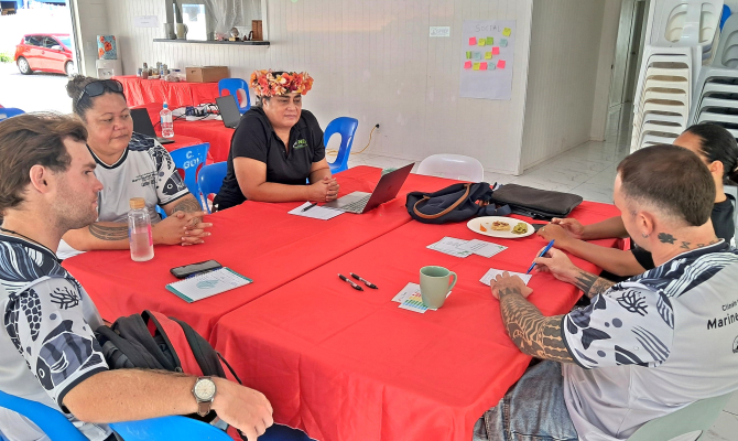
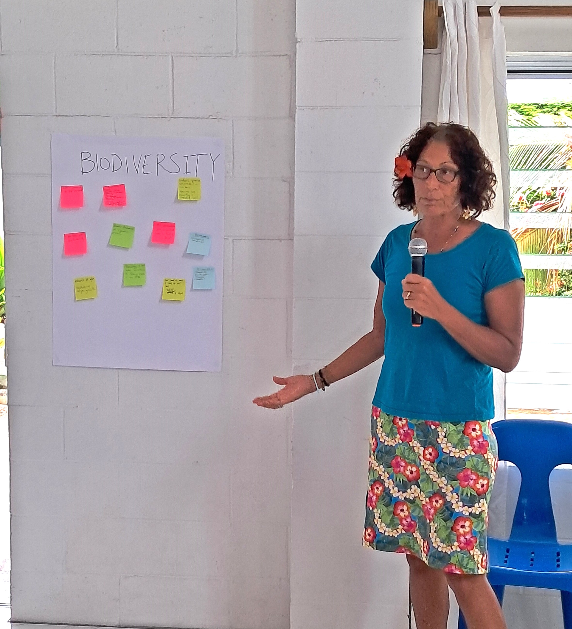
The main objective of the two-day workshop for Cook Islands was to consult with key stakeholders and actively co-develop a suite of climate and biodiversity-aligned MSP indicators, tailored to national circumstances, for monitoring and assessing how effective the national MSP process has been.
“However, planning alone is not enough,” added Ms Munro. “We also need to be able to measure our progress. Over the next two days, we will focus on co-developing clear and practical indicators that align with the Marae Moana framework, that can be realistically monitored within our national systems.”
The Exclusive Economic Zone (EEZ) of the Cook Islands, covering approximately 1.9 million square kilometres of the South Pacific Ocean, is of critical national importance, serving as the foundation for the country's economic future, environmental management, and sovereignty.
The government has declared this entire area as a multi-use marine park, known as Marae Moana, which is a pioneering "whole-of-ocean" marine management initiative formalised in 2017, through the Marae Moana Act.
The workshop is an output of a partnership between the Government of the Cook Islands, the Secretariat of the Pacific Regional Environment Programme (SPREP) and the Government of New Zealand. It is supported by the New Zealand-funded Climate and Biodiversity-Smart Marine Spatial Planning (CaB-Smart MSP) Programme, implemented by SPREP.
Over the two-day period, participants actively engaged in confirming national marine spatial planning priorities and acquired a shared understanding of MSP indicators – their purpose and role in tracking progress and their value in supporting improved governance, transparency, and enabling evidence-based decision-making. The gathering facilitated the open sharing of ideas, interactive discussion and practical group work, where participants evaluated potential indicators against a set of prioritisation criteria to determine whether they were relevant, realistic and fit-for-purpose.
“We, Cook Islanders have a significant calling and responsibility as indigenous guardians of the vast expanse of our ocean, on which our cultural heritage and livelihoods depend,” said Mr. Liam Kokaua of the Korero o Te ‘Orau, a local Environmental NGO.
“Marine Spatial Planning is underpinned by an integrated, inclusive and participatory process and therefore must demonstrate its effectiveness in incorporating livelihoods, culture, and community needs if it is to be considered successful, equitable, and sustainable. Thus, I am happy to have participated in the workshop this week and contributed to co-developing MSP indicators to provide the evidence needed to verify how well the MSP process has done this and what gaps remain.”
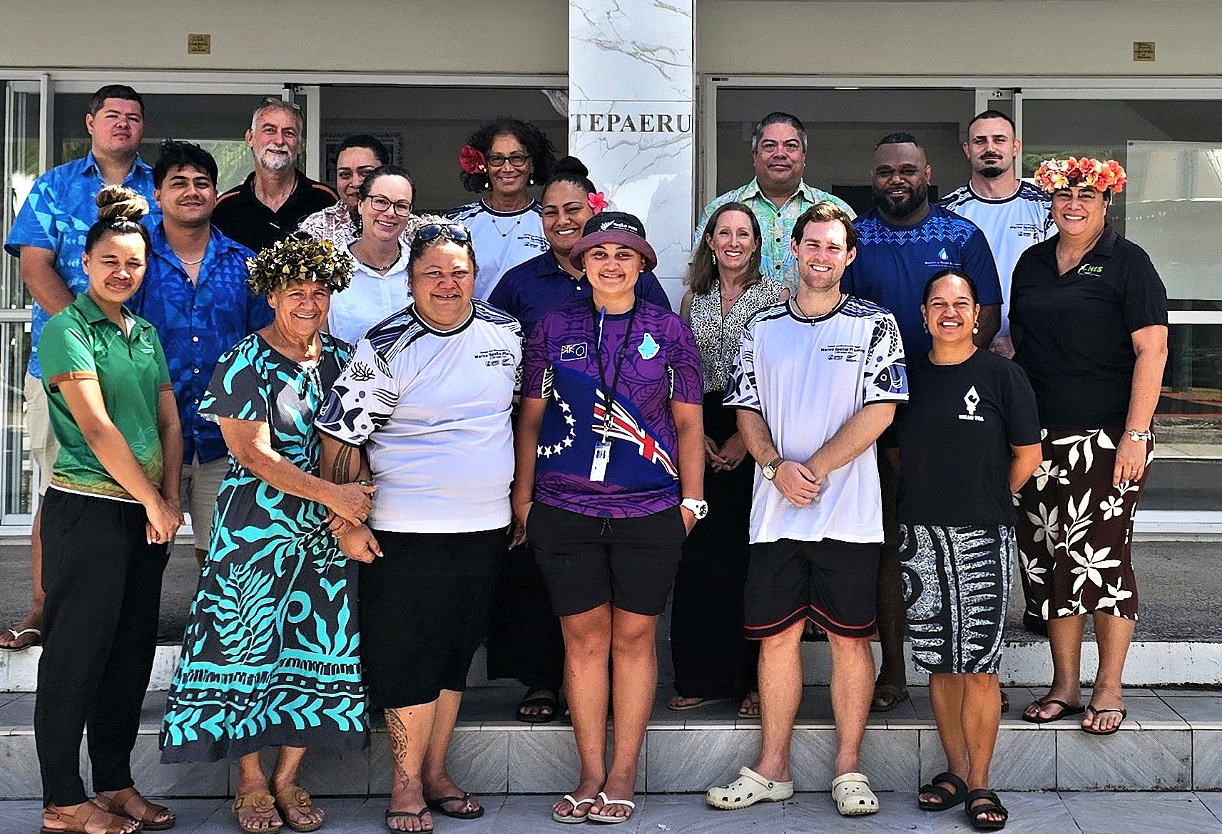
The workshop engaged a total of 22 participants from across key national agencies and NGOs including the Cook Islands National Environment Service, Ministry of Marine Resources, Infrastructure Cook Islands, Emergency Management Cook Islands, Cook Islands National Council of Women, Cook Islands Natural Heritage Trust, Te Ipukarea Society and Korero o Te ‘Orau.
The co-developed indicators will align with Cook Islands’ MSP objectives and policy frameworks, specifically the Marae Moana Policy and Act as well as broader national priorities around marine conservation and ocean management. These indicators will contribute to relevant national reporting obligations, including the national State of Environment reporting process for Cook Islands.
The national Climate and Biodiversity Smart MSP Indicators Co-Development Workshop for Cook Islands was held from 24-26 March 2026, facilitated by BMT Commercial Australia Pty Ltd, under contract to SPREP and was made possible through the Climate and Biodiversity-Smart Marine Spatial Planning Programme (CaB-Smart MSP), funded by the New Zealand Ministry of Foreign Affairs and Trade. The CaB-Smart MSP Programme underscores New Zealand’s commitment to assist Pacific Island nations in addressing and adapting to the challenges posed by climate change, it is part of New Zealand's broader International Climate Finance Strategy and aims to bolster the capabilities and capacities of Pacific Island countries to lead tailored approaches to marine spatial planning and marine protection. These approaches are designed to enhance marine conservation efforts, balance economic and conservation objectives, and fortify resilience against the adverse impacts of climate change.
SPREP leads on two multi-country components of the programme, which have a specific focus on strengthening understanding of how Traditional Knowledge and customary practice work alongside marine spatial planning and developing country-specific climate and biodiversity-relevant marine spatial planning indicators. Implementation of the Programme is being closely coordinated with regional partners including The Pacific Community (SPC) and aligns with and contributes to key regional frameworks such as the 2050 Strategy for the Blue Pacific Continent, the Framework for a Pacific Oceanscape and the Pacific Islands Regional Ocean Policy.
For more information on the CaB-Smart MSP Programme, please contact Vainuupo Jungblut Environmental Monitoring and Reporting Adviser vainuupoj@sprep.org and/or Mr. Patea Setefano, CaB Smart MSP Programme Coordinator patea.ext@sprep.org