
20 March 2026, Honiara – “Our Ocean is central to the identity, culture and livelihoods of Solomon Islanders. It supports our fisheries, our food security, our transport networks, our economic development, and the wellbeing of our communities. Therefore, improving how we coordinate and manage our ocean resources is a national priority.”
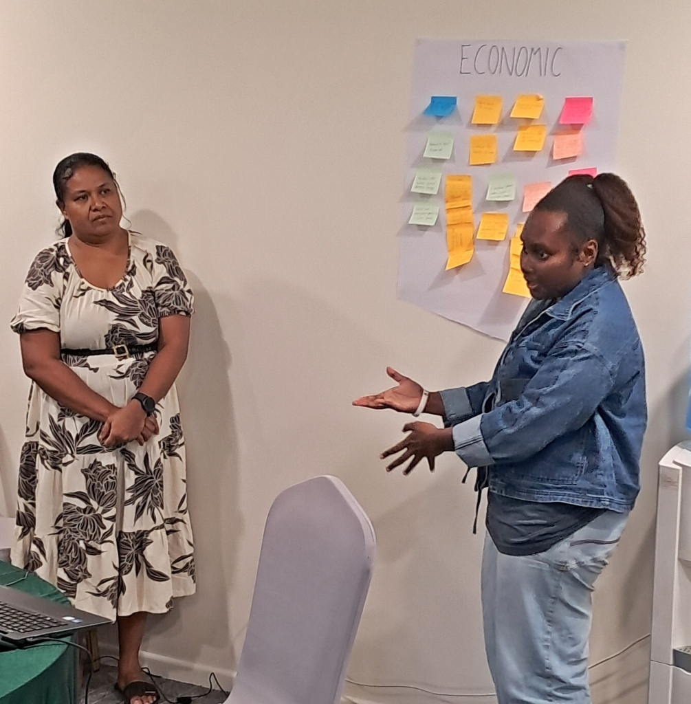
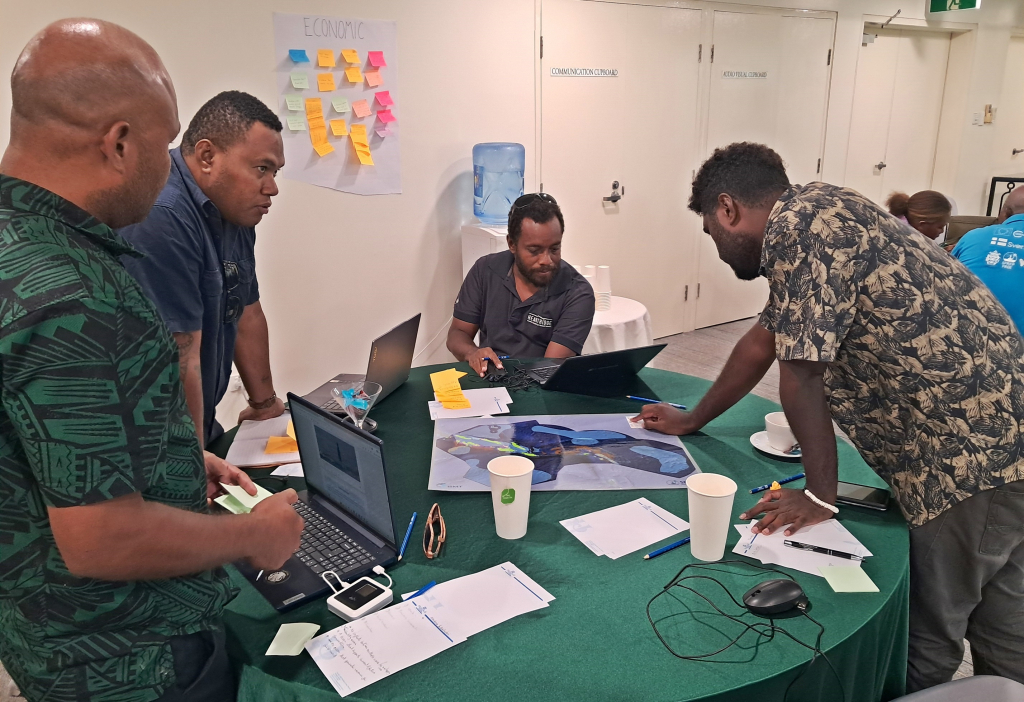
Those words from Mr. Brian Akwasia, Desk Officer, Ocean and Climate Change Desk, Ministry of Foreign Affairs and External Trade, set the tone for a national workshop held recently in the Solomon Islands to monitor the effectiveness and impact of the marine spatial planning (MSP) process in the country. The main objective of the two-day workshop for Solomon Islands was to consult with key stakeholders and actively co-develop a suite of climate and biodiversity-aligned MSP indicators, tailored to the national context, for monitoring and assessing the how effective island-scale MSP processes have been.
“Marine Spatial Planning is one of the tools we are using to support this goal. It has helped us plan for how our ocean space is used and provides a framework to bring together different sectors, strengthen coordination across ministries, and support better decision-making for the future of our ocean,” added Mr Akwasia.
The workshop was the culmination of a partnership between the Government of the Solomon Islands, the Pacific Regional Environment Programme (SPREP)and the Government of New Zealand. It is supported by the New Zealand-funded Climate and Biodiversity-Smart Marine Spatial Planning (CaB-Smart MSP) Programme, implemented by SPREP.
Solomon Islands Exclusive Economic Zone covers approximately 1.5 million square kilometres representing one of the largest ocean areas in the region. Situated in Melanesia, this expansive EEZ is vital for the nation’s fisheries and biodiversity, encompassing over 900 islands and significant coral reefs.
Over the two-day period, participants actively engaged in confirming national marine spatial planning priorities and acquired a shared understanding of MSP indicators – their purpose and role in tracking progress and their value in supporting improved governance, transparency, and enabling evidence-based decision-making. The gathering empowered the open sharing of ideas, interactive discussion and practical group work, where participants evaluated potential indicators against a set of prioritisation criteria to determine whether they were relevant, realistic and fit-for-purpose.
“Relevant and realistic Indicators are an essential means of evaluating the effectiveness of the marine spatial planning process and tracking whether expected outcomes are being achieved for Solomon Islands,” said Mr. Sylvester Diake, national CaB-Smart MSP Coordinator, Ministry of Fisheries and Marine Resources.
“The integrated nature of marine spatial planning requires indicators that link directly to national policy themes such as biodiversity health, community livelihoods, climate resilience, cultural integrity and sustainable economic growth. Thus, I am pleased that we are taking steps towards determining impact of our MSP process and ensuring that it is effective and adaptable to changing circumstances, needs and priorities.”
The workshop engaged a total of 21 participants from across key national agencies and NGOs including the Ministry of Fisheries and Marine Resources, Ministry of Environment, Climate Change, Disaster Management and Meteorology, Ministry of Foreign Affairs and External Trade, Solomon Islands National University, University of the South Pacific and the Wildlife Conservation Society, Solomon Islands.
The co-developed indicators will align with Solomon Islands’ MSP objectives and policy frameworks, specifically the Solomon Islands’ National Ocean Policy, the Solomon Islands MSP plan and as well as broader national priorities around marine conservation and ocean management. These indicators will contribute to relevant national reporting obligations, including the national State of Environment reporting process for Solomon Islands.
The national Climate and Biodiversity Smart MSP Indicators Co-Development Workshop for Solomon Islands was held from 11-13 March 2026, facilitated by BMT Commercial Australia Pty Ltd, under contract to SPREP and was made possible through the Climate and Biodiversity-Smart Marine Spatial Planning Programme (CaB-Smart MSP), funded by the New Zealand Ministry of Foreign Affairs and Trade. The CaB-Smart MSP Programme underscores New Zealand’s commitment to assist Pacific Island nations in addressing and adapting to the challenges posed by climate change, it is part of New Zealand's broader International Climate Finance Strategy and aims to bolster the capabilities and capacities of Pacific Island countries to lead tailored approaches to marine spatial planning and marine protection. These approaches are designed to enhance marine conservation efforts, balance economic and conservation objectives, and fortify resilience against the adverse impacts of climate change.
SPREP leads on two multi-country components of the programme, which have a specific focus on strengthening understanding of how Traditional Knowledge and customary practice work alongside marine spatial planning and developing country-specific climate and biodiversity-relevant marine spatial planning indicators. Implementation of the Programme is being closely coordinated with regional partners including The Pacific Community (SPC) and aligns with and contributes to key regional frameworks such as the 2050 Strategy for the Blue Pacific Continent, the Framework for a Pacific Oceanscape and the Pacific Islands Regional Ocean Policy.
For more information on the CaB-Smart MSP Programme, please contact Vainuupo Jungblut Environmental Monitoring and Reporting Adviser vainuupoj@sprep.org and/or Mr. Patea Setefano, CaB Smart MSP Programme Coordinator patea.ext@sprep.org